Canberra Studio: Connecting Russell

Master plan illustrates the connection of Russell with the Parliament House by tram and redesigns the connection of CauseWay
Canberra’s contemporary urban character is often described as an ‘urban laboratory’ - a blend of City-Beautiful and Garden-City elements. Post War social, economic, cultural and political factors have greatly influenced the city’s current form. As a result the Griffin’s plan has only been partly realised. Today the city is cut off from the lake, it’s blocks dominated by poorly planned office precincts, which diminish the intended qualities of the capital.
‘Connecting Russell’ focuses on regenerating the piece of Canberra to provide new land use, parkland and waterfront access opportunities. It re-interprets the geometry of the Griffin Plan by identifying strong axes to
several varied precincts. The character of Russell is enhanced through the distribution of built form that increases living and working densities whilst maintaining a relationship to the scale of the mature landscape. A sustainable-mobility approach has been used to establish a legible street network. Contemporary pressures such as local traffic congestion have been considered particularly east to west between Civic and the airport.
Strategically the project places emphasis on the city approaching and addressing its parkland and waterfront with a multi-functional edge street with civic engagement. The plan envisages walkable blocks with a range of
building types and subdivisions supported by low-carbon and responsive transport systems - such as light rail.

Residential Precinct Detail (scale 1:1000)

Parkes Way Precinct Detail (scale 1:1000)
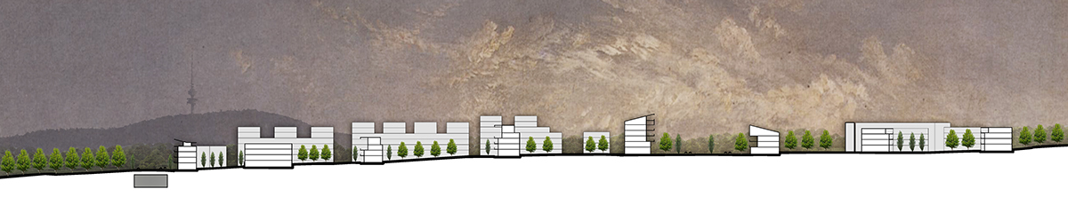
Long Section shows the terrace and the ideas of designing the Market Place and Parks Way

Street Section Across Constitution Avenue

Perspective View of Constitution Avenue

Aerial View of Russell Precinct
Venice Studio: Urban Axis
Urban Axis is a master planned city that integrates the human scale of medieval Venice and the vast industrial scale of Porto Marghera into a functional urban precinct. The vision of the city is to establish a network of attractive open space to welcome international and local visitors arriving at the new Porto Marghera cruise terminal, and to create a series of liveable urban neighbourhoods for the Venetian population.

Master Plan Sections along the water edge
The Blue Green Hinge develops the main green elements of the Urban Axis master plan shown on the preceding pages. A linear axis of parkland elements runs the length of the site and integrates different architectural and landscape programs. The spine provides a scenic experience for
visitors. Storm water from the site is collected and used within the landscape areas. Water features are integrated into the green space.
visitors. Storm water from the site is collected and used within the landscape areas. Water features are integrated into the green space.
The green axis connects the park in the north of the site to the concert hall at the southern-most tip of the site. The green spaces offer respite from the high density precinct. The walking experience is enhanced through
sculptural manipulation of levels within the park. The different levels open up view corridors to different parts of the site.
sculptural manipulation of levels within the park. The different levels open up view corridors to different parts of the site.
The park is integrated with the road and public transport system and connects people from different areas to the concert hall and foreshore areas.

Views of Board walk along the water edge
